
The GISIG Training Library is a catalogue of training modules created by experts in Geographic Information Science and Technology.
All Modules are developed in the context of European research projects / training initiatives and consists of self-learning presentations, videos, exercises and text lectures. Training materials are hosted in Moodle eLearning platforms managed by GISIG, freely available and licensed under a Creative Commons license. To get more information on the training offer or in case of technical problems accessing the modules, please contact us.
New and featured training modules
The following is a selection of the newest training modules hosted in our training platforms. All modules links point to external pages. In order to access the materials, registration will be required.

From INSPIRE to e-Government
This self-learning module identifies e-government processes and explains the relation between e-government and INSPIRE.- Author: Danny Vandenbroucke (SADL/KU Leuven).
- Format: 3 video-lectures and self-tests.
- Date: V1.0, November 2020.

Monitoring and understanding emerging geospatial technologies
This self-learning module discusses the major (technological) trends that affect the geospatial community.
- Authors: Danny Vandenbroucke (SADL/KU Leuven), Gobe Hobona (OGC)
- Format: 1 video-lecture and self-test.
- Date: V1.0, November 2020.
INSPIRE Network Services
This self-learning module explains how web services work with particular attention on OGC Web Services and how INSPIRE has built upon them.
- Authors: Paul Jacxsens, Ann Crabbé and Danny Vandenbroucke (SADL/KU Leuven).
- Format: 1 video-lecture and self-test.
- Date: V4.0, December 2020.
Principles for Data and Metadata Harmonisation according to INSPIRE
This self-learning module gives an overview of the principles of interoperability and harmonisation in INSPIRE.
- Authors: Stefania Morrone, Giacomo Martirano (EPSILON ITALIA)
- Format: HTML5 presentation.
- Date: V0.1, November 2020.
Training Packages
All training materials developed for a given research project or initiative configure a so-called Training Package. A Training Package is structured around a webpage where you can get full information on the modules available an how to access them.
Browse the list of available training modules (some modules can be found in more than one Package) and visit the dedicated webpage for each Package.

EO4GEO project
EO4GEO will provide a rich training offer in the context of the Copernicus programme and related activities.TRAINING TOPICS: COPERNICUS SENTINEL DATA EARTH OBSERVATION COPERNICUS SERVICES- Solar resource and forecasting at municipality level
- Active fire detection with Sentinel-3 data
- EO for urban greenery management
- Early warning for disease epidemics at regional level
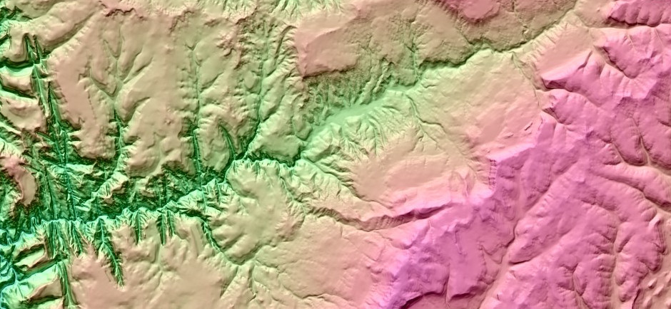
- Optical Earth observation data for landslide risk management
- Air quality monitoring and management
- Fast disaster response – satellite technologies for surface displacement monitoring
- A new Common Agricultural Policy (CAP) based on Copernicus programme and EO4GEO tools
- The rise of Artificial Intelligence for Earth Observation
- Evaluation and planning of urban green structures
- Landslide affecting Cultural Heritage sites
- CO2 budgets for municipalities
- EO and GI: a crucial tool to monitor and tackle climate change
- Identification of heat islands to support city planning
- Earth Observation for Decision Makers
- Object-based Image Analysis – An Introduction
- Observando desde el espacio: Agricultura y medio ambiente
- Copernicus Atmosphere Monitoring Service
- Copernicus Climate Change Service
- Flood mapping with synthetic aperture radar
- EO Data Sources
- Urban Heat Islands – Basic GIS knowledge vector and raster data
- Reproducibility Research in the Geosciences
- Programación SIG en entornos Web: Introducción a Leaflet.js
- Fundaments of optical remote sensing
- Change Detection Using EO Data
- Introductory exercise course to remote sensing
- Sentinel-2 data and vegetation indices
- Management view on SDI
- Introduction to SDI Architecture and Components
- Introduction to GIS
- Classification: Decision Trees
- Classification: Random Forests
- Preprocessing of EO data
- Validation of EO Products
- Copernicus Service – Land
- Urban Heat Islands – Understanding the concept of EO time series
- Urban Heat Islands – Basic analysis tutorial
- The EO4GEO project
- Accessing EO Data Using Terrascope Platform
- Terrascope Application Development
- Image processing and analysis

giCASES project
This package includes GIS and thematic case-based learning material jointly created by universities and industrial partners.TRAINING TOPICS: WEB MAPPING INDOOR LOCATION INSPIRE SDI FORESTRY GIS UNDERGROUND MANAGEMENT- Introduction to geospatial web and web geoservices
- Geospatial web servers and clients to create Web Mapping applications
- Indoor positioning and applications
- Technical specifications of the indoor positioning system
Case study: Environmental analysis
- Environmental analysis using cloud service system
Case study: Location Enablement of e-Government
- From INSPIRE to e-Government
- Introduction to Agile development methods
Case study: Integrated management of underground infrastructure
- Underground Infrastructure
- Basic principles of the management of district heating networks
- Managing Complex Distribution Networks
Case study: Harmonizing data flows in Energy saving EU policies
- Geodata sharing on the Web: GeoNode
- INSPIRE data and metadata harmonisation in the energy saving domain
Case study: GIS Applications in Forestry
- Forest Management
- Forest Fire Management

ARinfuse project
ARInfuse is an Erasmus+ Project that aims to infuse skills in Augmented Reality for Geographical Information Management in the Water Utility Sector.TRAINING TOPICS: AUGMENTED REALITY GIS BIM WATER UTILITY SECTOR- ARinfuse tool documentation
- ARinfuse tool tutored exercise
- Putting AR in operation
- From Spatial Data to Augmented Reality
- Visualisation of Underground Utility Networks in Augmented Reality
- Underground Infrastructure
- Urban drainage and sewerage
- Operations and maintenance of underground assets
- Water supply system
- General aspects of waste water treatment plants
- Introduction to GIS
- Introduction to BIM
- Introduction to Photogrammetry
- Introduction to Geodesy
- Indoor positioning and applications

INSPIRE Knowledge Base
The official European Commission’s INSPIRE Directive training catalogue hosted and maintained by GISIG.TRAINING TOPICS: INSPIRE DATA HARMONISATION DATA VALIDATION METADATA LINKED DATA- Introduction to INSPIRE
- INSPIRE Data and service sharing
- Basic concepts of XML and GML
- INSPIRE Data Specifications
- Data Quality
- INSPIRE Network Services
- Data Harmonisation
Category: Advanced technical Modules
- Procedures for Data and Metadata Harmonisation
- Examples of Data Transformation
- Metadata and Data Validation for INSPIRE
- Metadata and Catalogue Services
- INSPIRE Network Services – advanced
Category: Technological trends and innovative solutions
- INSPIRE advanced
- Introduction to Linked Data
- Linked Data Advanced

GeoSmartCity project
This package includes modules required to cope with the INSPIRE implementation, themathic knowledge and training to adopt the GeoSmartCity infrastructure.TRAINING TOPICS: GIS INSPIRE UNDERGROUND MANAGEMENT GREEN ENERGY- Introduction to INSPIRE
- Basic of INSPIRE Data Specification
- Basic of INSPIRE NetworkServices
- Data Harmonisation
- Procedure for Data and Metadata Harmonisation
- Examples of Data Transformation
- Metadata and Data validation for INSPIRE
- Introduction to Linked Data
Category: GIS Technologies
- GIS Introduction
- Data visualization & Cartography
- Geo-Crowdsourcing: Open Street Map workflow
Category: Underground Management
- Urban drainage & Sewerage
- Operation and Maintenance of Underground Assets
- Water Supply System
- Water and wastewater pollution characterization and sources
- General aspects of waste water treatment plant
Category: Green Energy
- The European Energy Policy Strategy
- Energy efficiency in buildings
- The Covenant of Mayors
Category: The GeoSmartCity Infrastructure
- GeoSmartCity Data Models
- GeoSmartCity Specialised Services
- GeoSmartCity Data Catalogue
- GeoSmartCity Web and Mobile Clients
Category: The GeoSmartCity Pilots
- The GeoSmartCity Pilot Applications

LINKVIT project
This Package includes training material about the context knowledge to operate in INSPIRE and the related technical procedures.TRAINING TOPICS: INSPIRE DATA SPECIFICATIONS DATA HARMONISATION DATA VALIDATION LINKED DATAThe Training Package is also available in Italian.- Introduction to INSPIRE
- European Geospatial Portals as SDI User Interfaces
- Basics of INSPIRE Data and service sharing
- Basic concepts of XML and GML
- Basics of INSPIRE Data Specifications
- Data Quality
- Basics of INSPIRE Network Services
- Data Harmonisation
Category: Advanced technical Modules
- INSPIRE advanced
- Metadata and Catalogue Services
- INSPIRE Network Services advanced
- Procedures for Data and Metadata Harmonization
- Examples of Data Transformation
- Metadata and Data validation for INSPIRE
Category: Modules addressed to the stakeholders of Nature Conservation
- Nature Conservation & Natura 2000 Network
- Nature Conservation & INSPIRE
Category: Modules addressed to the stakeholders of Geology and Civil Protection
- Risk Management
- Geological data harmonization
Category: Technological trends and innovative solutions
- Introduction to Linked data
- Linked Data Advanced
- Introduction to Sensor Web enablement

eENVplus project
This Package includes training material on INSPIRE, training on the technical outcomes of eENVplus and regarding the project’s Pilot Applications.TRAINING TOPICS: INSPIRE NATURE CONSERVATION DATA HARMONISATION RISK MANAGEMENT SEIS- Introduction to INSPIRE
- Basics of INSPIRE Data and service sharing
- Basics of INSPIRE Data Specifications
- Basics of INSPIRE Network Services
- Data Harmonisation
- Procedures for Data and Metadata Harmonisation
- Towards the ICT implementation of SEIS
- Good Practices for Environmental Management
- Introduction to Linked Data
Category: Knowledge on specific related knowledge areas
- Water Directives
- Nature Conservation and Natura 2000 Network
- Nature Conservation and INSPIRE
- Risk Management
- Geological Data Harmonisation
Category: Knowledge on the technical outcomes of eENVplus
- Examples of Data Transformation
- Metadata and Data validation for INSPIRE
- The eENVplus Architecture
- The eENVplus Thesaurus Framework
- The eENVplus services
- eENVplus catalogue and connection to operational infrastructures
- Mobile Mapping and advanced visualisation
Category: eENVplus scenarios
- Implementation of a SEIS for air quality data (Belgium)
- Implementation of a SEIS for air quality data (Italy)
- Providing INSPIRE-compliant access to utility services: the case of sewage networks in Flanders
- CSspire
- Natural Areas INSPIRE Compliance Toolbox
- Forest Fire Management Scenario
- Window on the Protected Areas – Mobile Conservation Map (WMA MCM)
- INSPIRE Geoportal
- Geological Map Harmonization
- Land Cover change detection and planning indicators

i-locate project
This Package includes training material regarding indoor and outdoor localisation of people and objects.TRAINING TOPICS: INDOOR LOCATION INDOOR GML ROUTING INDOOR OSM- Introduction to INSPIRE
- Indoor Location Technologies
- Security, Privacy, Ethics
- Basic concepts of XML and GML
- OGC indoor GML
- Routing and graph theory
- Introduction to licensing agreements
- Indoor OSM
Category: Knowledge on the technical outcomes of i-locate
- i-locate Toolkit
- Data acquisition pipeline
- Indoor graph management within IndoorGML
- Asset management through extension of IndoorGML
- i-locate portal installation
- Routing and Graph Theory:Advanced Module
Category: The i-locate Pilot applications
- The i-locate Pilot applications

smeSpire project
This Package includes training material to enable the participation of SMEs in the INSPIRE Implementation.TRAINING TOPICS: INSPIREDATA SPECIFICATIONSDATA HARMONIZATIONBPMNMETADATA- Introduction to INSPIRE
- INSPIRE advanced
- Introduction to costs/benefits of INSPIRE & possible opportunities
- Introduction overview of Technological Geospatial Trends and potential opportunities/benefits for the geo-ICT market
- Introduction to Business Process Modelling – BPMN
- of INSPIRE Data and service sharing
- Basics of INSPIRE Data Specifications
- INSPIRE Data Specifications advanced
- Procedures for Data and Metadata Harmonization
- Metadata and Data validation for INSPIRE
- Examples of Data Transformation
- Hands-on training: How to publish data as Linked data
- Introduction to Sensor Web Enablement
- Basics of INSPIRE Network Services
- INSPIRE Network Services advanced
- Innovative Cloud Computing solutions
- Introduction to Linked Data
- Introduction to Social Media

LIFE+IMAGINE project
This Package deals with training material regarding the integrated management of coastal zones and the implementation of environmental policies in the sector.TRAINING TOPICS: RISK MANAGEMENT GEOLOGICAL DATA HARMONIZATION COASTAL ZONES INSPIRE- Introduction to INSPIRE
- Basics of INSPIRE Data Specification
- Basics of INSPIRE Network Services
- Data Harmonisaton
- Procedures for Data and Metadata Harmonisation
- Examples of data transformation
- Metadata and data validation for INSPIRE
- Towards the ICT implementation of SEIS
- Copernicus
Category: Thematic Knowledge
- Risk Management
- Geological Data Harmonization
Category: The LIFE+IMAGINE infrastructure
- The LIFE+IMAGINE Architecture
- The LIFE+IMAGINE web services
Category: Scenarios Application and Use Cases
- Soil Consumption calculation and its application at national/municipal level
- Landslides impact assessment and specific applications
- Integrated Coastal Zone Management and the coastal sediment balance